Complete Results @ http://www.newx-forecasts.com/
Follow the left-panel link from '24th Annual Snow Storm Contest > Verified Forecasts > ‘Storm #4’ to see the complete forecasters’ verification table by station.
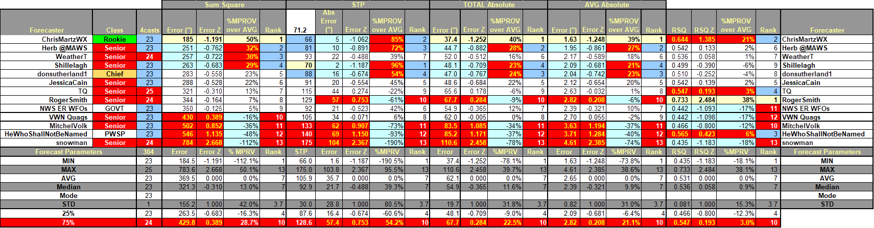
In the table ...
Yellow cells indicate the best score in category.
Forecast STP cells: yellow if within +/- 5% of observed STP.
Blue (Red) cells indicate the 25% (75%) percentile.
SUMSQ: sum of square errors (measure of forecast accuracy accounting for magnitude and distribution of snowfall)
STP: storm total precipitation
TAE: total absolute error
AAE: average absolute error
Final Standings - all Forecasters
---
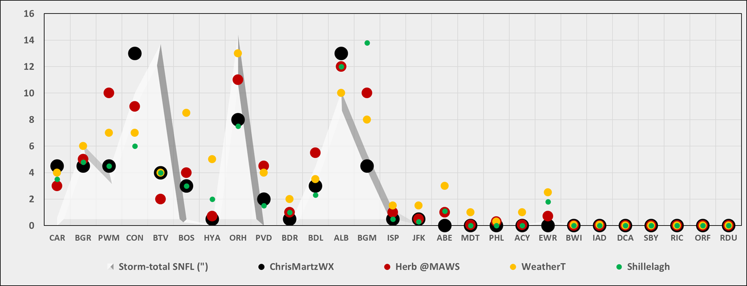
Station by Station Comparison of Top 4 Forecasts and Observed Storm-total Snowfall (STP)
---
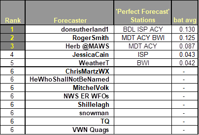
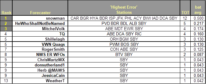
Perfect Forecasts (Batting Average - Forecast Stations with No Error)
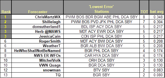
Best Station Forecasts (Batting Average - Forecast Stations with Lowest Absolute Error)
Best Station Forecast Busts (Batting Average - Forecast Stations with Highest Absolute Error)
Skill v. NWS ER WFOs
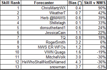
Positive skill value indicates a forecast/s improvement over the NWS forecasts.
Bias - the arithmetic difference between the average Forecast snowfall and the average Observed snowfall (averageForecast) – averageObserved).
---
Consensus Forecasts … Extremes … and Observed Snowfall
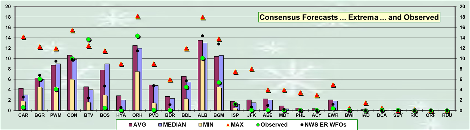
Consensus forecast best @ BGR … CON
MAX forecast best @ BTV
MAX forecast less than observed @ none
MIN forecasts best @ CAR … PWM … BOS … HYA … PVD … BDR … ALB … BGM …JFK … ABE … EWR
MIN forecasts more than observed @ CAR … PWM
---
Total Absolute Error and SUMSQ Error
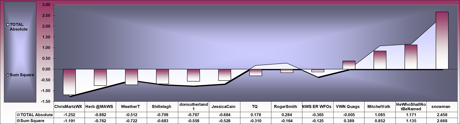
Strong correlation (R = 0.966) between SUMSQ and TAE Z-scores
---
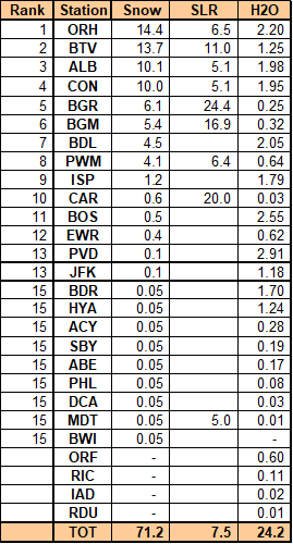
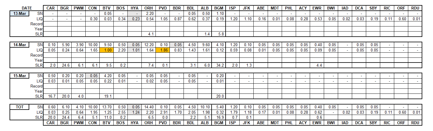
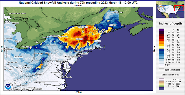
Forecast by Observed Snowfall Scatterplots (Top 4 Forecasts)
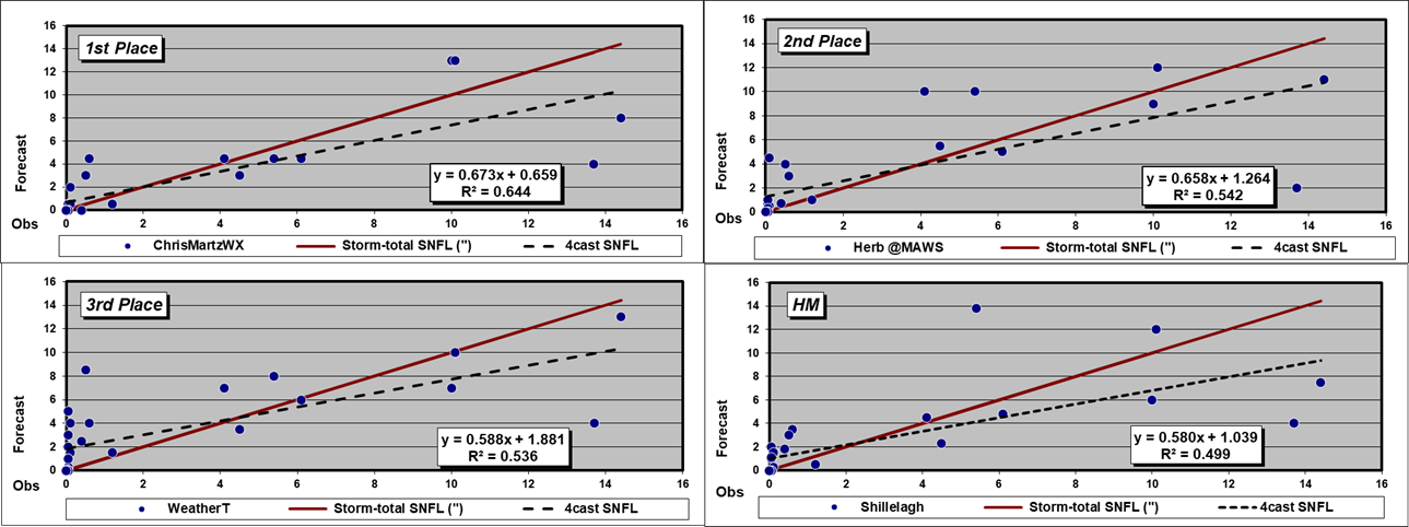
A dashed Forecast trend line above (below) solid red Observed snowfall line ==> over (under) forecast
R2 value indicates how well the forecast captured the observed snowfall’s variability … i.e., R2 = 0.874 ==> the forecast captured ~87% of the observed snowfall’s variability.
---
Verification of storm-total snowfalls for MON through WED
based on reporting from CDUS41 (CLI) ... CXUS51 (CF6) ... METARs ... and PNS bulletins
issued by NWS.
Generally excellent coverage and reporting with CON and BDR as the exceptions.
HYA
'Trace' STP retrieved from METAR and vicinity reports carried by BOSPNS.
Blizzards conditions at BGR (if you let them slide for being
5” short of 3-hour duration requirement) …
KBGR 142235Z 02020G31KT 1/4SM R15/2800V4500FT SN FG BKN005 OVC008 01/M01
A2938 RMK AO2 PK WND 03033/2223 SFC VIS 1/2 P0002 T00061006 $
KBGR 142220Z 03022G33KT 1/8SM R15/3000V4000FT SN FG OVC007 01/M01 A2937 RMK AO2 PK WND 36033/2213 SFC VIS 1/2 P0002 T00061006 $
KBGR 142153Z 02020G37KT 1/8SM R15/2400V4500FT SN FG OVC004 01/M01 A2938 RMK AO2 PK WND 36044/2125 SFC VIS 1/2 SLP951 SNINCR 1/6 P0006 I1001 T00061006 $
KBGR 142120Z 36022G42KT 1/8SM R15/2400V3000FT SN FG VV004 01/M01 A2938 RMK AO2 PK WND 36042/2114 SFC VIS 1/2 PRESFR P0003 I1001 T00061006 $
KBGR 142053Z COR 02020G35KT 1/8SM R15/2000V3000FT +SN FG VV004 00/M01 A2942 RMK AO2 PK WND 02035/2047 SFC VIS 1/4 SLP964 SNINCR 2/4 P0004 60005 T00001006 56043 $
KBGR 142040Z COR 02024G35KT 1/8SM R15/2000V2800FT +SN FG VV004 00/M01 A2944 RMK AO2 PK WND 03035/2038 SFC VIS 1/4 P0003 T00001006
Snowfall rates of 2” / hr observed at BTV and BDL …
KBTV 141754Z 35011KT 1/4SM R15/2000V2600FT +SN FG VV005 00/M01 A2961 RMK AO2 SLP030 SNINCR 2/13 4/013 P0012 60060 T00001006 10006 20000 58007
KBTV 141745Z 36010KT 1/4SM R15/2000V2800FT +SN FG VV004 01/M01 A2962 RMK AO2 P0011 T00061006
KBTV 141716Z 03009KT 1/4SM R15/2000V2400FT +SN FG VV006 01/00 A2963 RMK AO2 P0004 T00060000
KBTV 141654Z 03008KT 1/2SM R15/2600V3000FT SN FG VV006 01/00 A2963 RMK AO2 SLP037 SNINCR 2/11 P0014 T00060000
KBTV 141622Z 36006KT 1/4SM R15/2200V3000FT +SN FG VV005 01/00 A2963 RMK AO2 P0007 T00060000
KBTV 141612Z 02008KT 1/2SM R15/2600V2800FT SN FG VV005 01/00 A2963 RMK AO2 P0004 T00060000
KBTV 141554Z 36006KT 1/4SM R15/2000V3500FT +SN FG VV005 01/00 A2963 RMK AO2 SLP037 SNINCR 2/9 P0015 T00060000
KBTV 141745Z 36010KT 1/4SM R15/2000V2800FT +SN FG VV004 01/M01 A2962 RMK AO2 P0011 T00061006
KBDL 140951Z 36014G20KT 1/2SM R06/5500VP6000FT -SN BR VV009 01/M01 A2947 RMK AO2 SFC VIS 1 SLP981 SNINCR 2/3 P0023 T00061006 $
Note ALB/s low SLRs. Snow falling at 1” / hr with hourly liquids (SLRs) of 0.13” (~8:1) … 0.12” (~8:1) … 0.17” (~6:1) … and 0.16” (~6:1)
KALB 140951Z 35009KT 1/2SM R01/5000VP6000FT SN FG VV007 01/M01 A2960 RMK AO2 SLP026 SNINCR 1/5 P0016 T00061006
KALB 140935Z 34010KT 1/2SM R01/5000V6000FT SN FG VV007 01/M01 A2961 RMK AO2 P0013 T00061006
KALB 140921Z 34009KT 1/2SM R01/5000V5500FT -SN BR VV006 01/M01 A2961 RMK AO2 SFC VIS 3/4 P0011 T00061006
KALB 140903Z 33009KT 1/2SM R01/3000V5000FT SN FG VV006 01/M01 A2962 RMK AO2 P0004 T00061006
KALB 140851Z 33008KT 1/4SM R01/2800V4000FT +SN FG VV006 01/M01 A2963 RMK AO2 TWR VIS 1/2 SLP034 SNINCR 1/4 P0017 60042 T00061006 56028
KALB 140847Z 33008KT 1/4SM R01/3500V5000FT +SN FG VV006 01/M01 A2963 RMK AO2 TWR VIS 1/2 P0016
KALB 140840Z 33008KT 1/2SM R01/4000V5500FT SN FG VV006 01/M01 A2963 RMK AO2 P0014 T00061006
KALB 140830Z 33009KT 1/4SM R01/3000V4000FT +SN FG VV005 01/M01 A2963 RMK AO2 TWR VIS 1/2 P0011 T00061006
KALB 140751Z 33008KT 1/2SM R01/4000V5500FT SN FG VV005 01/M01 A2964 RMK AO2 SLP039 SNINCR 1/3 P0012 T00061006
KALB 140746Z 33008KT 1/2SM R01/4500VP6000FT SN FG VV006 01/M01 A2964 RMK AO2 P0011
KALB 140726Z 32008KT 1/2SM R01/5500VP6000FT -SN BR VV006 01/M01 A2966 RMK AO2 SFC VIS 3/4 P0007 T00061006
KALB 140651Z 34008KT 1/2SM R01/4500VP6000FT SN FG FEW004 OVC008 01/M01 A2968 RMK AO2 SLP053 SNINCR 1/2 P0013 T00061006
KALB 140623Z 34007KT 1/2SM R01/5000VP6000FT SN FG SCT003 OVC007 01/M01 A2970 RMK AO2 P0006 T00061006
KALB 140616Z 34007KT 1/2SM R01/6000VP6000FT SN FG OVC004 01/M01 A2970 RMK AO2 P0005 T00061006
KALB 140551Z 35007KT 1/2SM R01/6000VP6000FT -SN BR BKN004 OVC009 01/M01 A2971 RMK AO2 SFC VIS 3/4 SLP063 4/001 P0008 60035 T00061006 10033 20006 56033
---
Snow-to-Liquid Ratios (SLR) of less than 5:1 are unreported for stations where liquid
and / or freezing precipitation also occurred during the verification period.
---
Stations observing >= Trace: 23 (85%)
Stations observing > Trace: 14 (52%)
Given stations had measurable snowfall; stations observing at least:
4" - 8 (30%)
8" - 5 (19%)
12" - 2 (7%)
MAX snow melt-water (minimum SLR 8:1)
BTV - 1.25"
BGM - 0.32
BGR - 0.25
MAX precipitation (frozen + freezing + liquid)
PVD - 2.91"
BOS - 2.55"
ORH - 2.20"
---
New daily snowfall record(s)
none
---
Orange cells indicate new daily record.
Grey cells indicate data source(s) as PNS and / or METARs.
Trace amounts (0.05") not included in TOT STP.
---
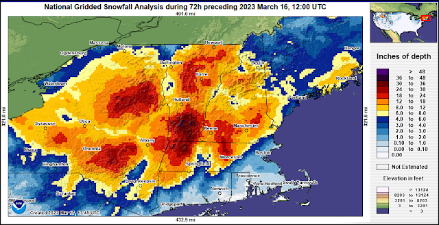
Approximate areal distribution of storm-total snowfall courtesy NOHRSC
---
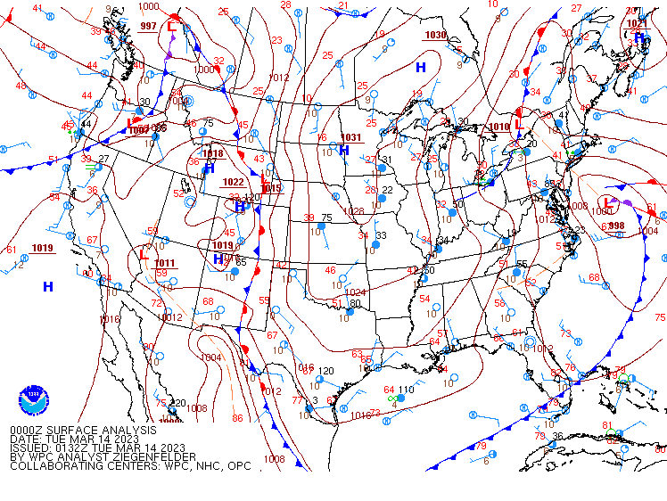
SFC analysis: 18z ... 14-MAR-23 and Storm-total Snowfall by Station
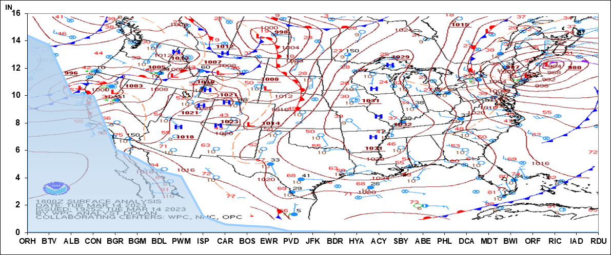
Images courtesy DOC / NOAA / NWS / NCEP / WPC
https://www.wpc.ncep.noaa.gov/html/avnsfc.shtml
---
Teleconnections
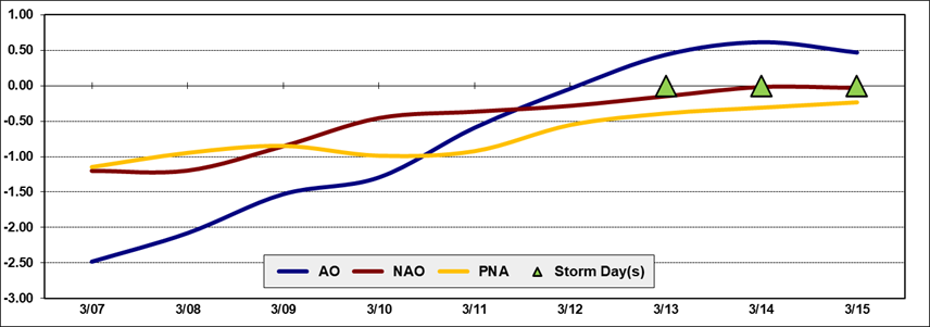
Teleconnection time-series data courtesy CPC
---
Upper Air
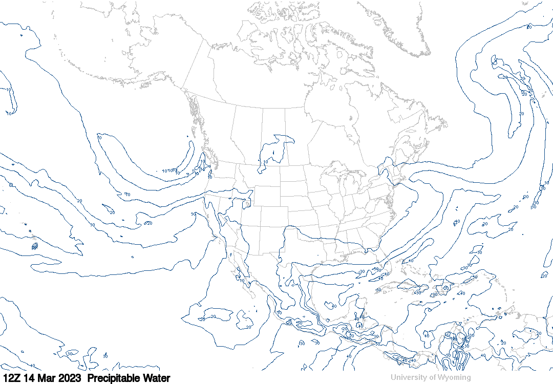
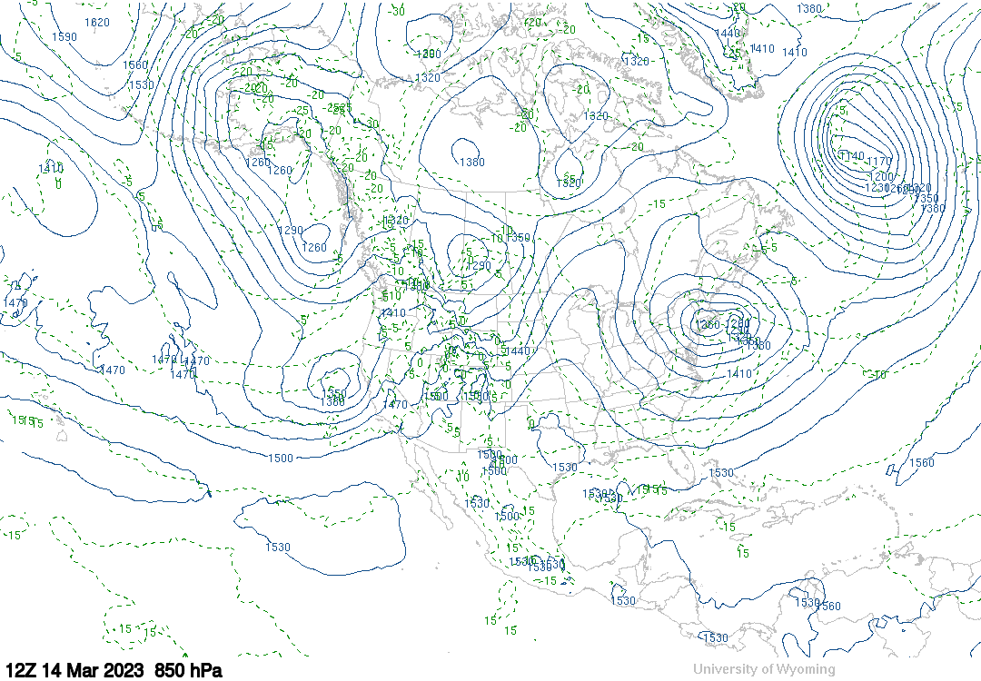
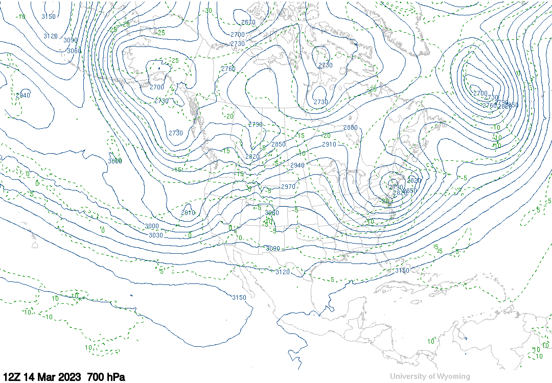
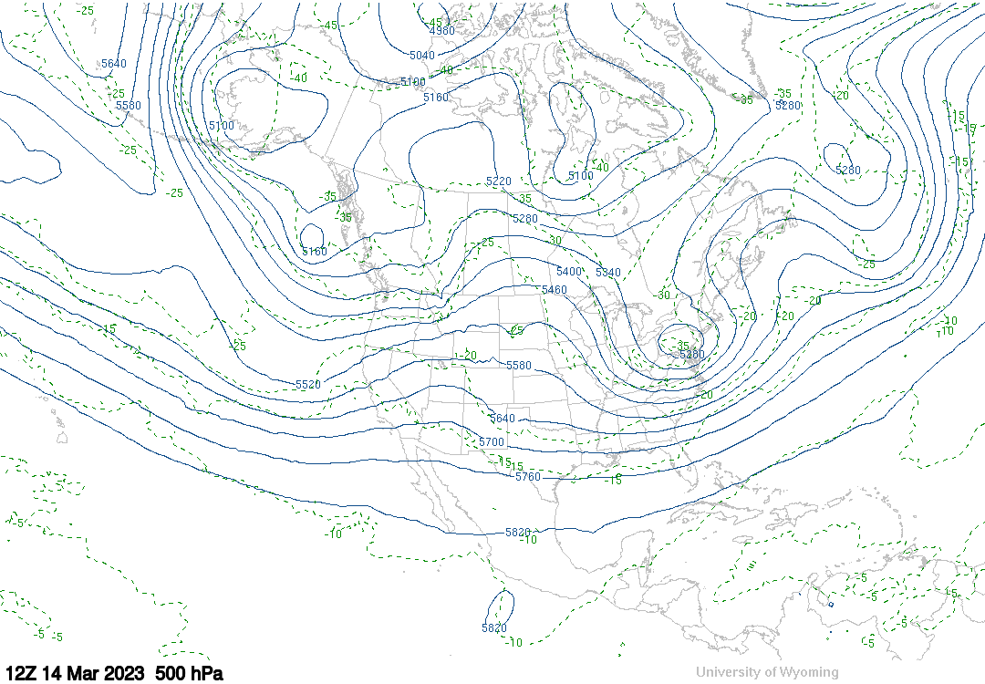
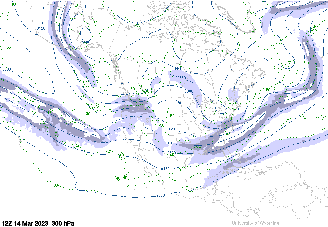
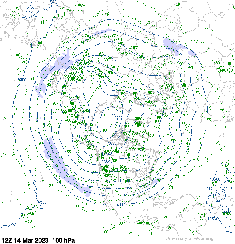
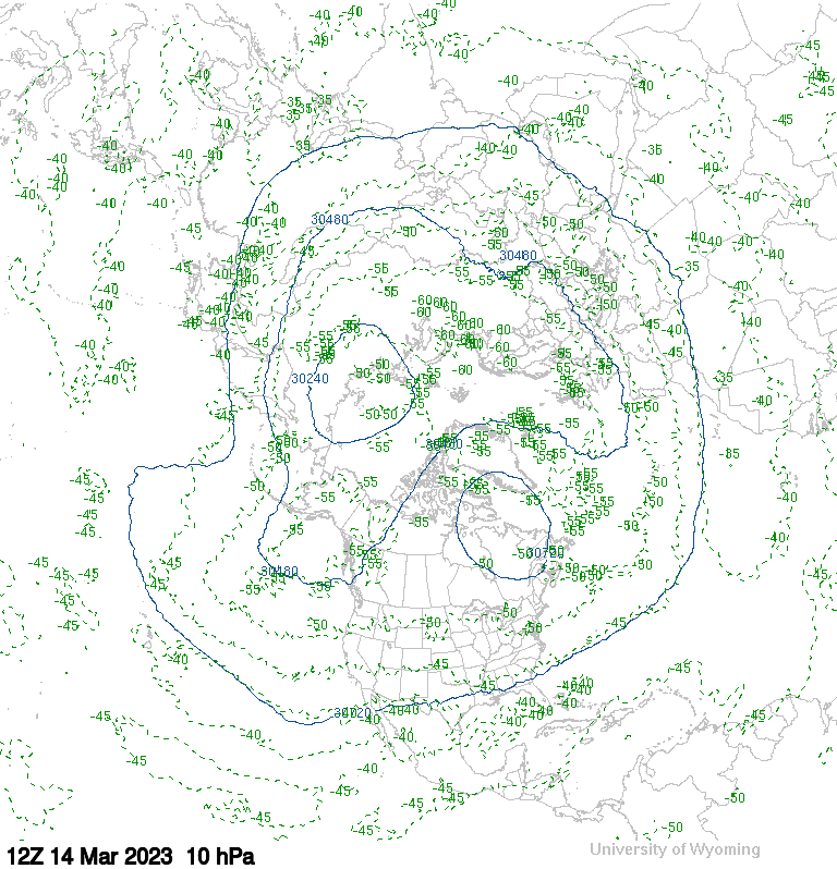
Upper air charts courtesy University of WY
---
SFC analysis
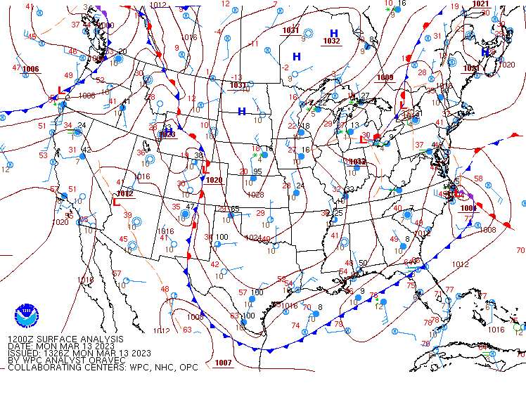
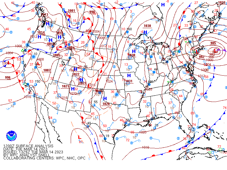
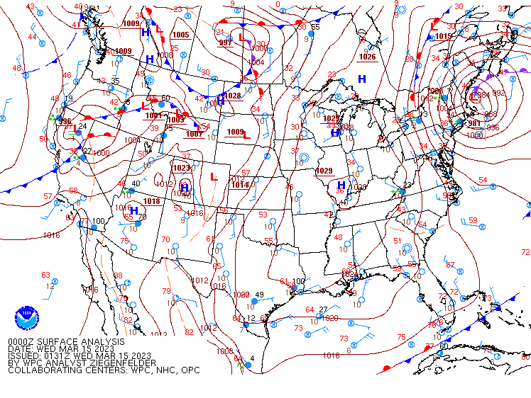
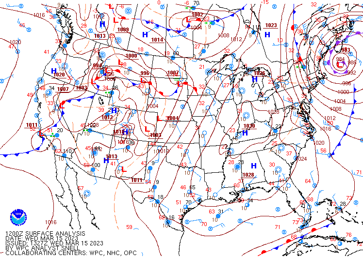
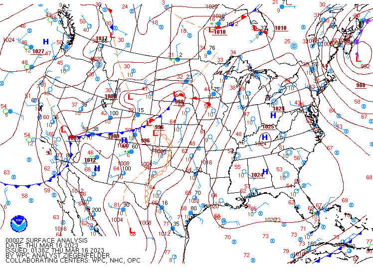
Images courtesy DOC / NOAA / NWS / NCEP / WPC
https://www.wpc.ncep.noaa.gov/html/avnsfc.shtml
---
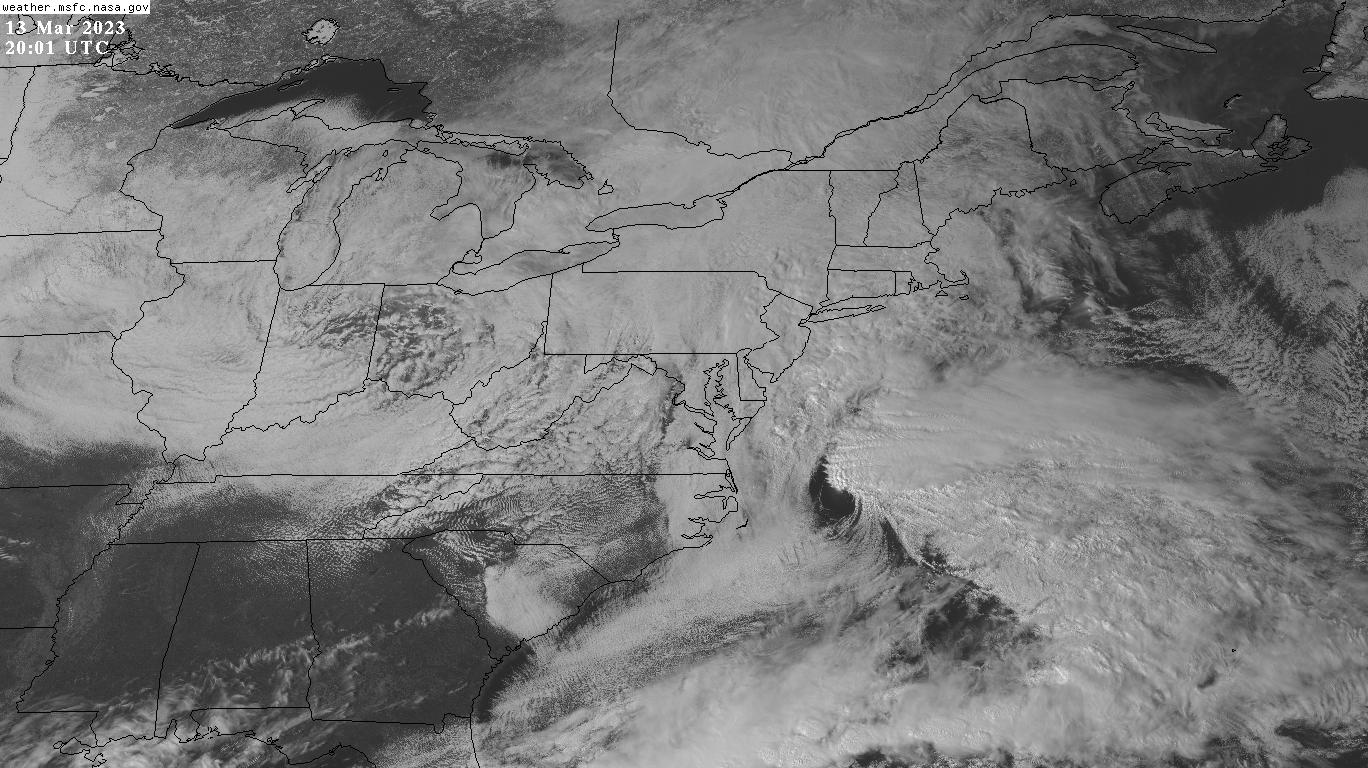
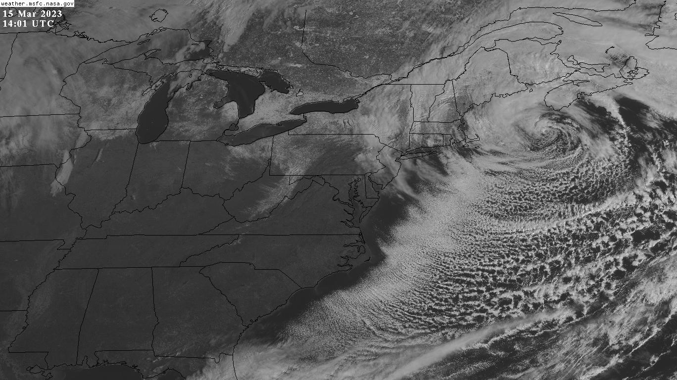
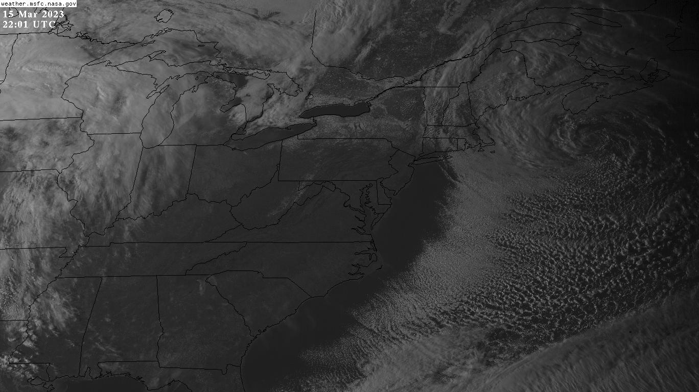
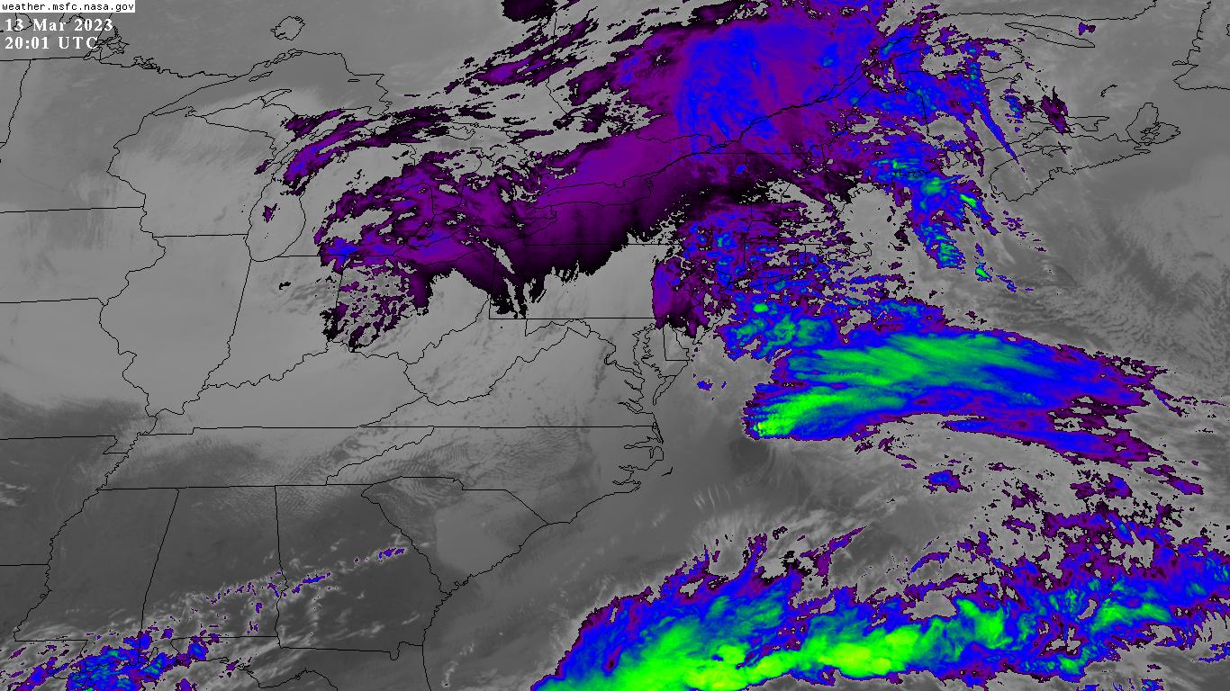
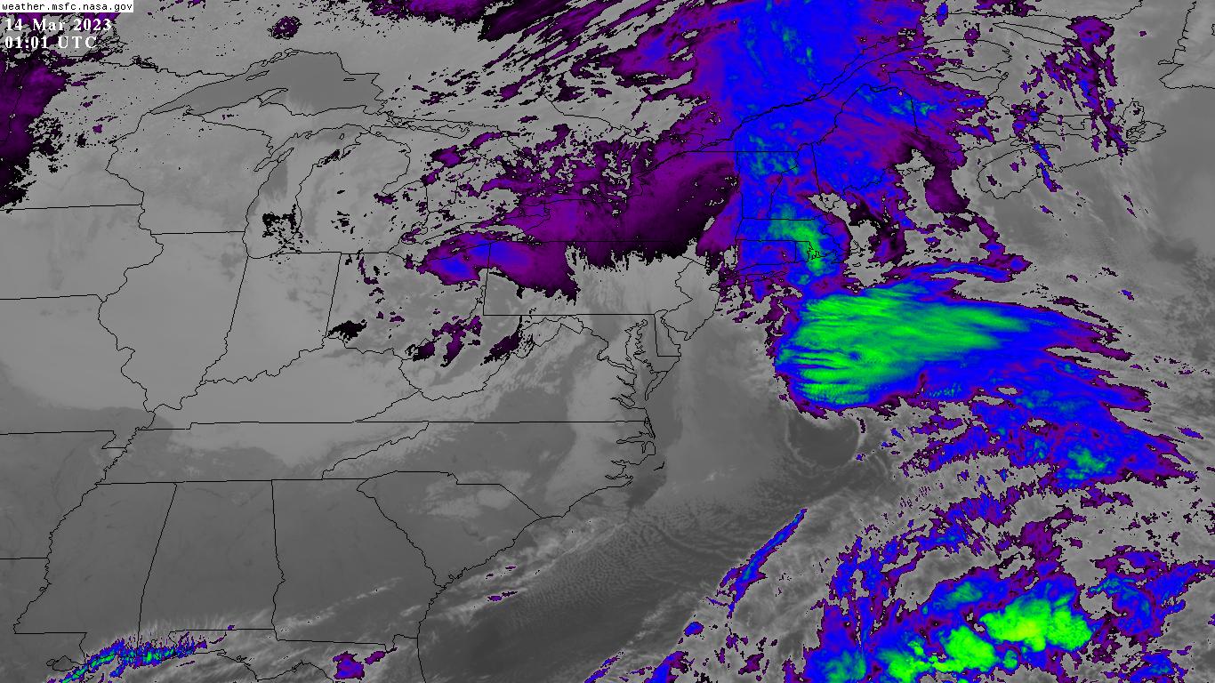
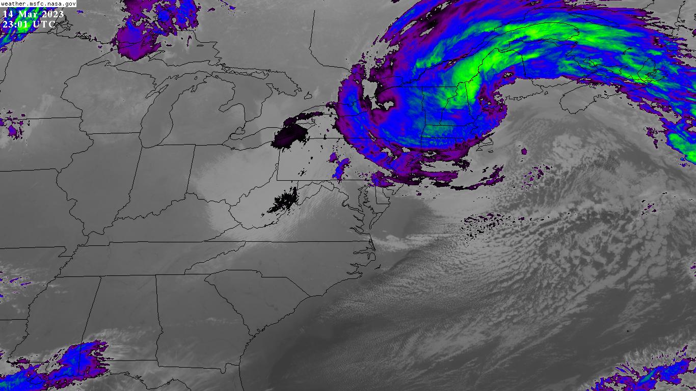
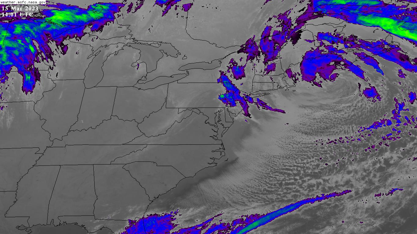
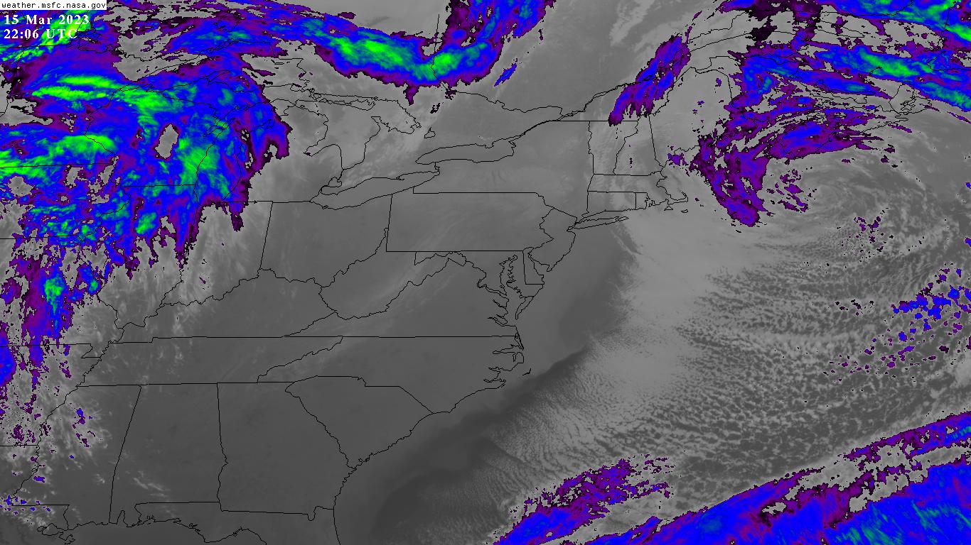
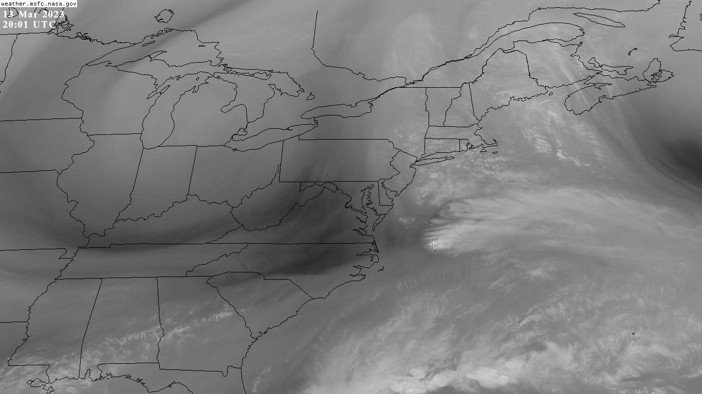
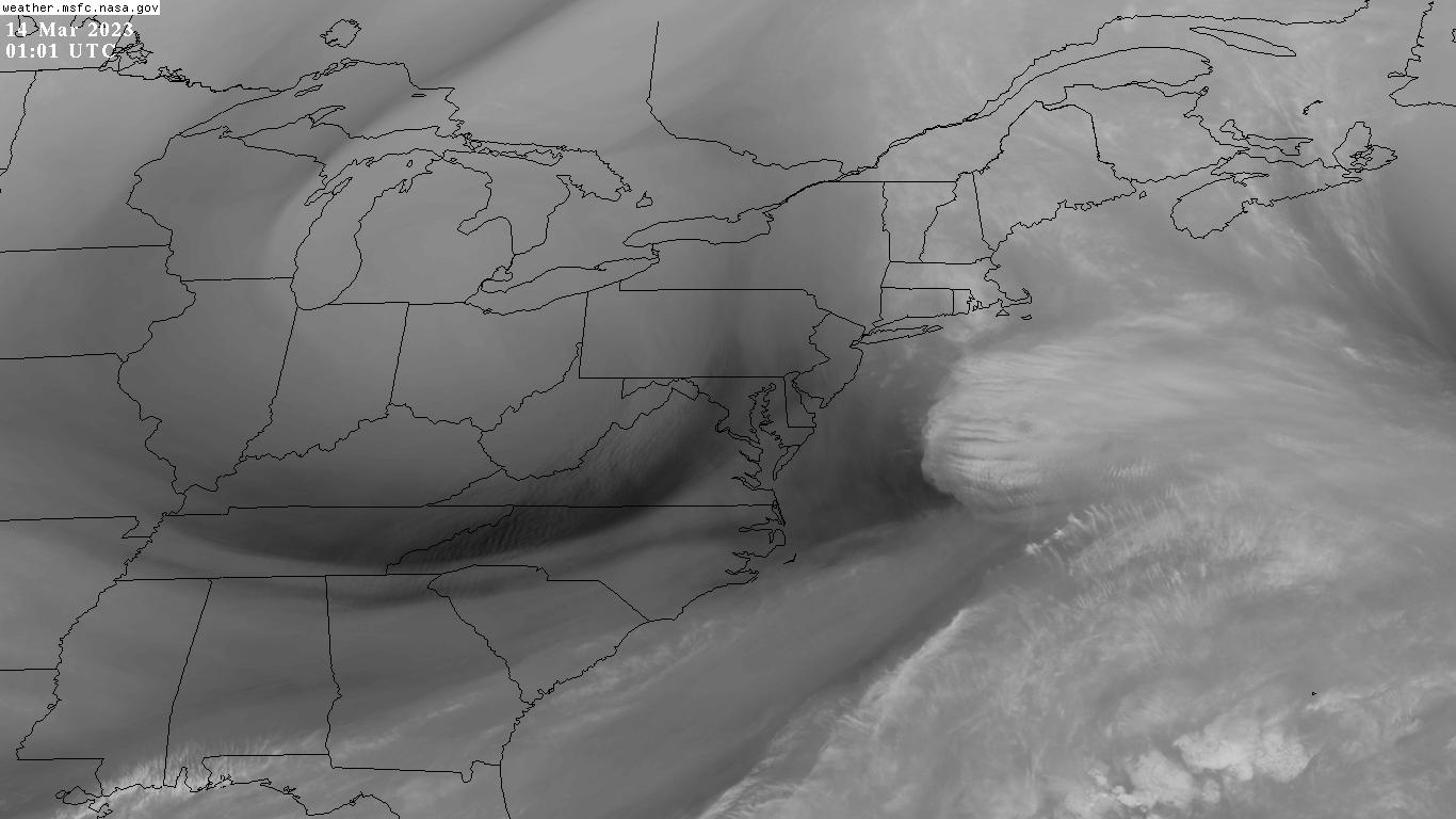
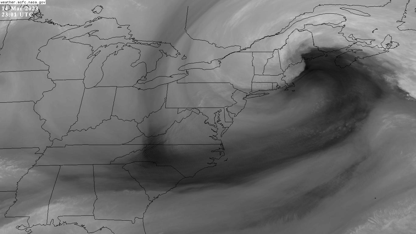
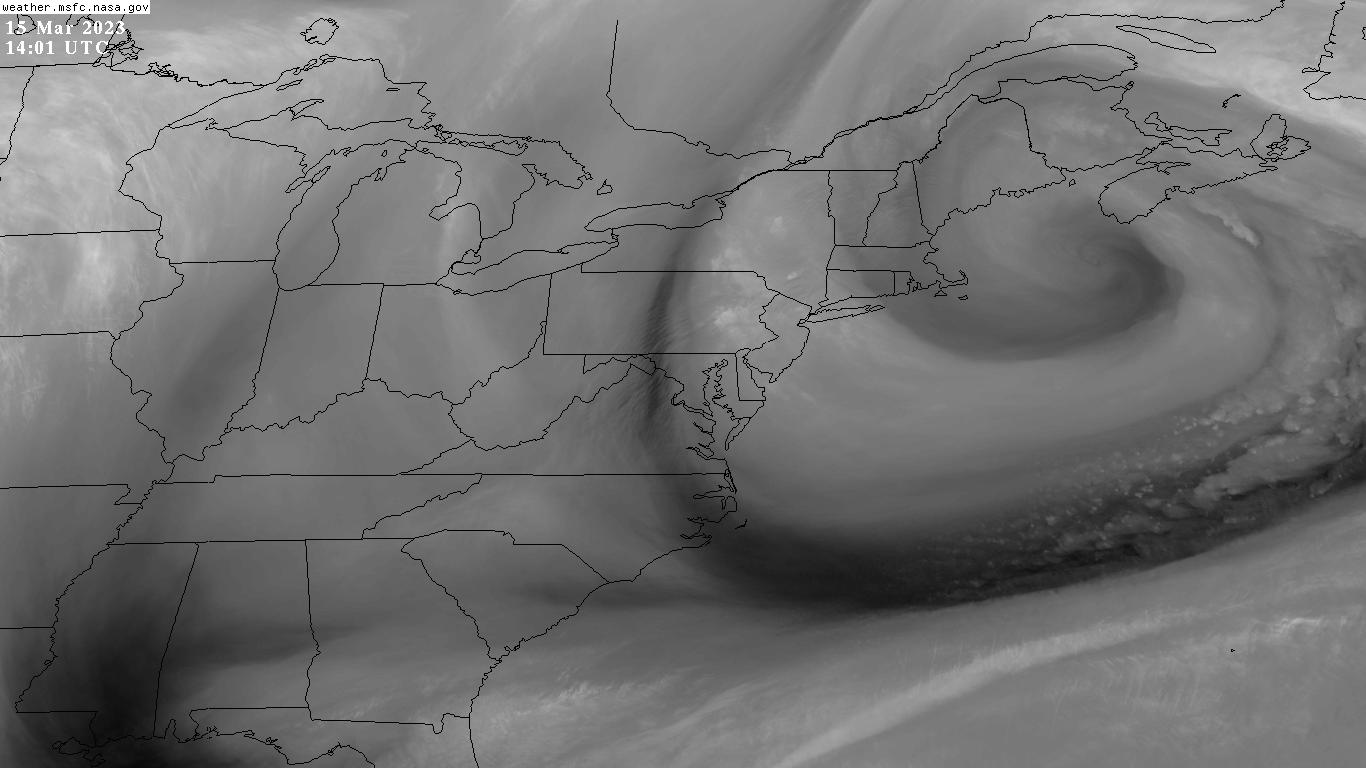
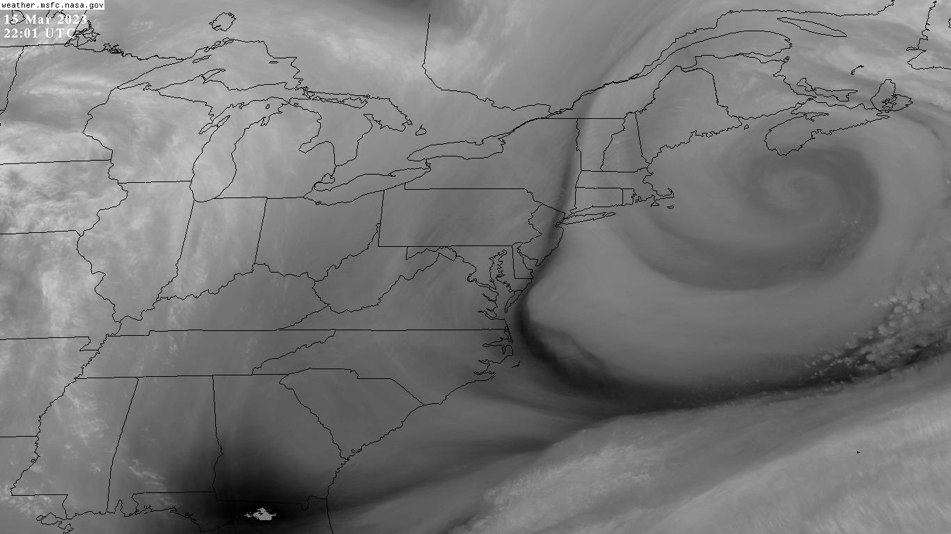
Satellite imagery courtesy George C. Marshall Space Flight Center Earth Science Branch
---
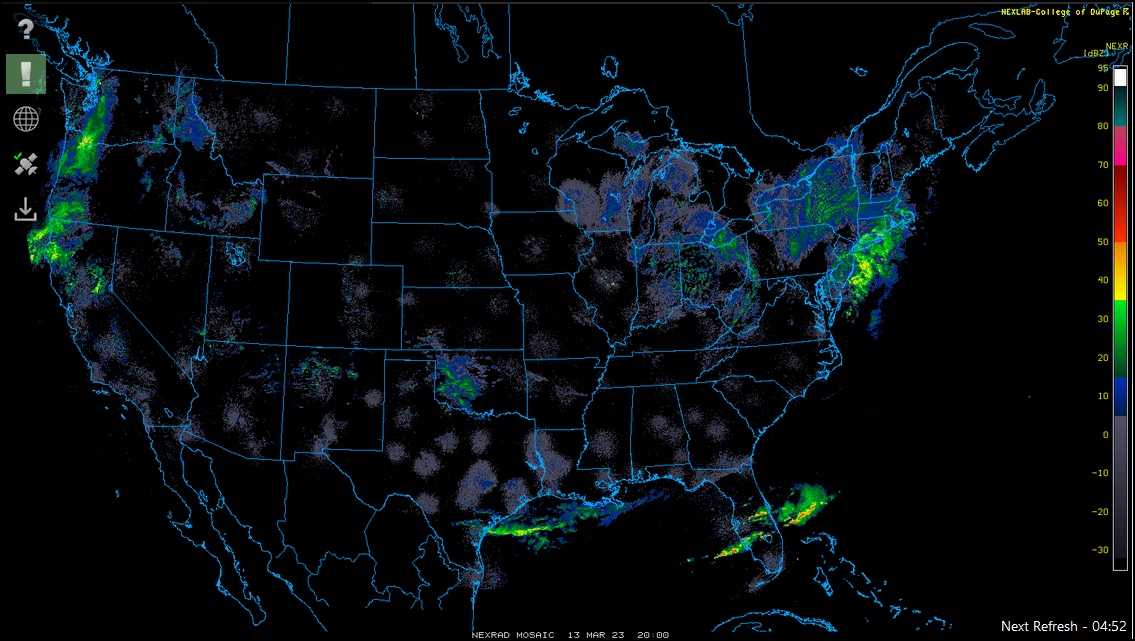
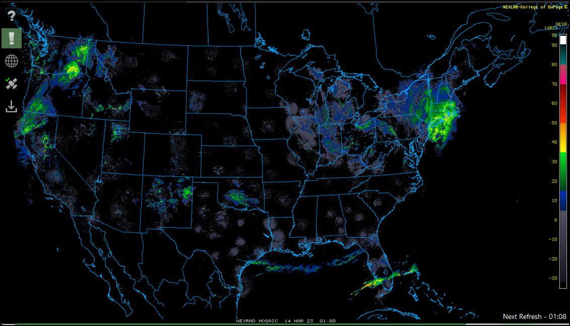
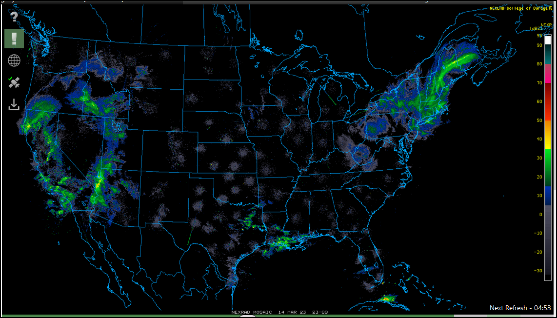
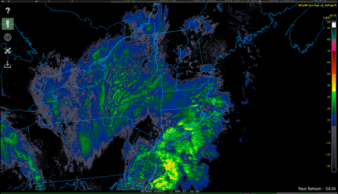
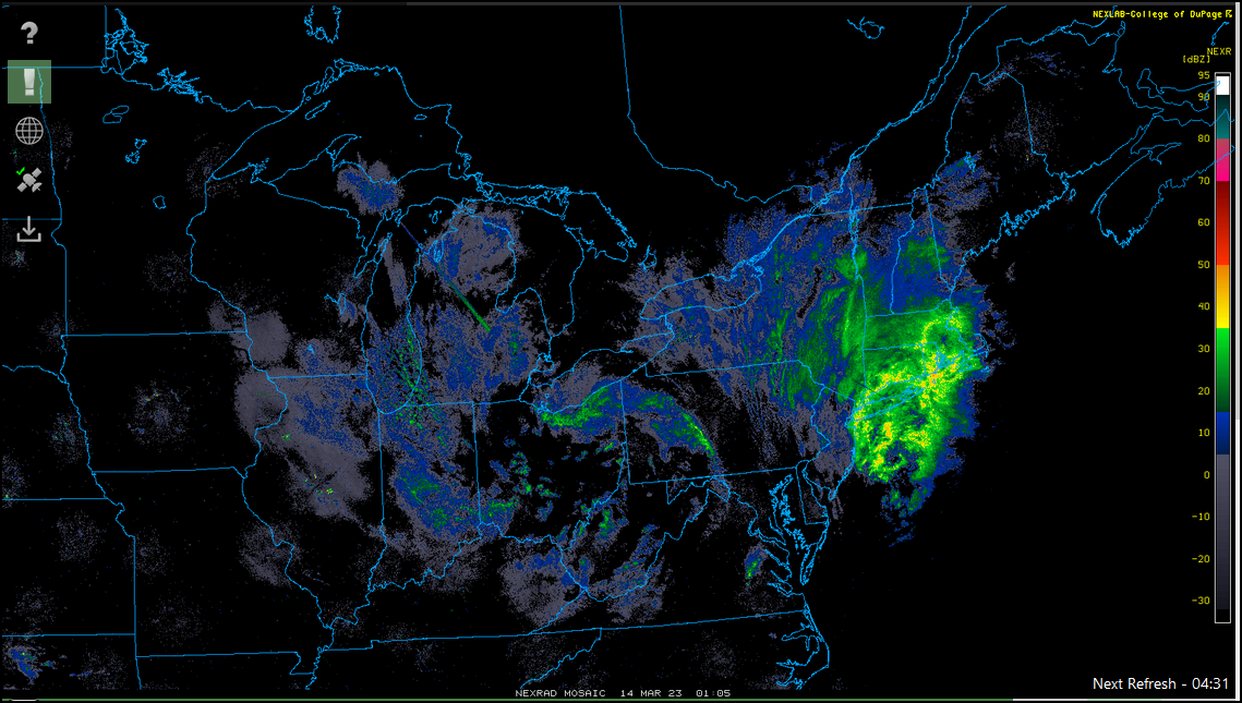
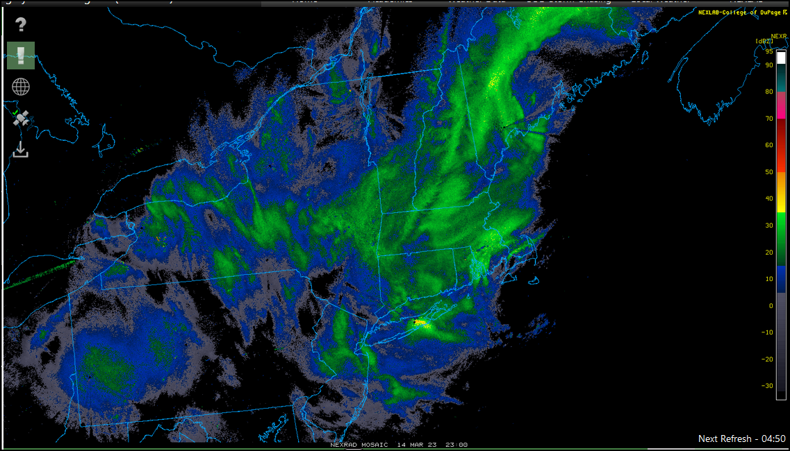
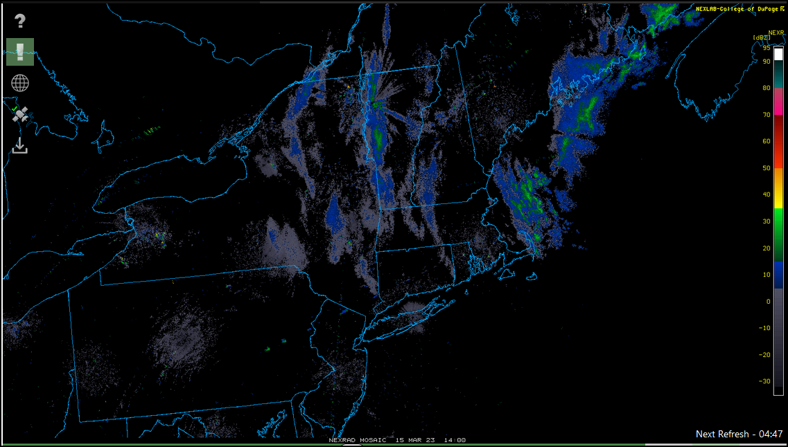
Radar imagery courtesy College of DuPage NEXLAB